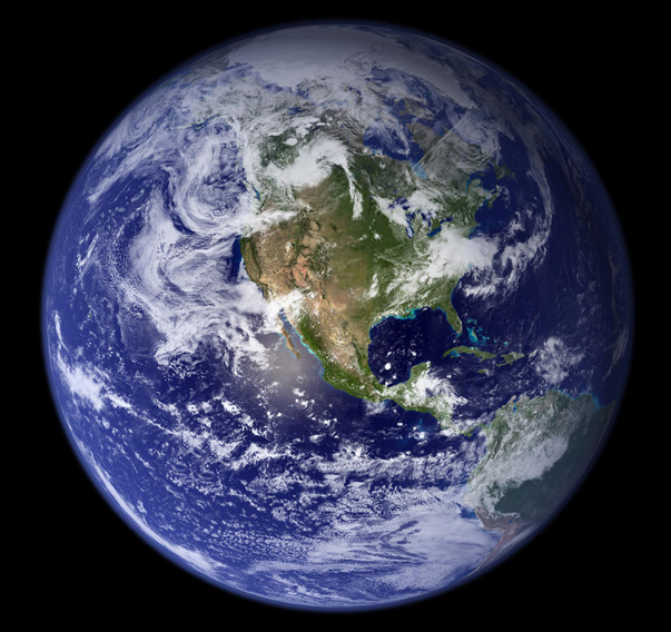
The most detailed true-color image of the entire Earth created to date. Using a collection of satellite-based observations, scientists and visualizers stitched together months of observations of the land surface, oceans, sea ice, and clouds into a seamless, true-color mosaic of every square kilometer of our planet. Much of the information contained in this image came from a single remote-sensing device-NASA's Moderate Resolution Imaging Spectroradiometer, or MODIS. Flying over 700 km above the Earth onboard the Terra satellite. (NASA/Goddard Space Flight Center)
Tuesday, May 04, 2010
Earth
![]()
Subscribe to:
Post Comments (Atom)


No comments:
Post a Comment